

|
U. S. CIVIL WAR
PHOTOGRAPHS
|

|
RICHMOND VA. - OUTLYING AREA

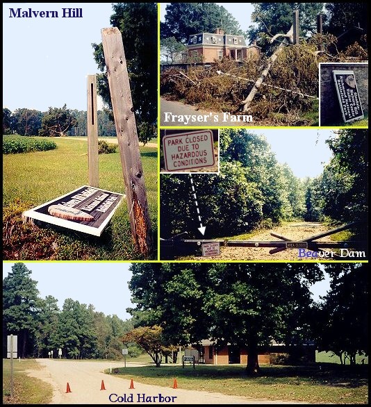
A few photographs, taken 9-21-2003, reflecting Hurricane Isabel's visit
| |
In 1998, the National Park Service gave us permission to use the Richmond
National Battlefield map as an image map on this site. Since then we have
completely redrawn the map, and, as a result, the map (below) should no longer
be considered a National Park Service product. The National Park Service is
not responsible for any errors and omissions (i.e., missing roads, etc.) on
the redrawn map.
The current Richmond National Battlefield map, available from N.P.S. locations,
(not the map we provide below) is more accurate and is certainly more readable.
Also, there is, below, a link to Robert E. Lee's reports on the seven-days
battles (which are included in this section). It will give you a better
perspective of the events of that period and General Lee's impression of
them. We recommend you read his reports.
Content Team
March 9, 2011
|
|
ROBERT E LEE'S REPORT ON THE
1862 (SEVEN DAYS) BATTLES
|
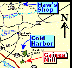
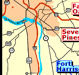
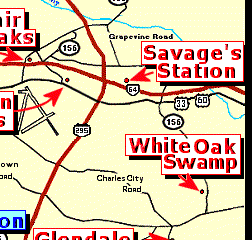
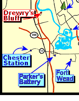
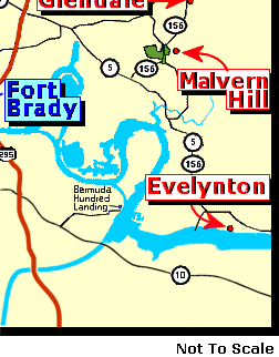
GREATER RICHMOND AREA MAP
|
(To visit a single battlefield, click on its name on the map.
|
| |
red
|
=1862 battles,
|
blue
|
=1864 battles.)
|
|
| |
|
Visit all of the 1862 or 1864 battlefields on this
site.
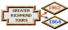
PROCEDURE:
Click on the 1862 or 1864 link at the bottom of this page to
start your tour. At each battlefield site you will find at the bottom of
the last page on that site an image similar to this:
 Clicking on the "Previous" link will take you back to the last battlefield you
visited; The "Richmond Tour" link will return you to this page, and the "Next"
link will take you forward to the
next battlefield in the campaign. Clicking "Next" on the last battlefield will
return you to this page.
Clicking on the "Previous" link will take you back to the last battlefield you
visited; The "Richmond Tour" link will return you to this page, and the "Next"
link will take you forward to the
next battlefield in the campaign. Clicking "Next" on the last battlefield will
return you to this page.
|
To start the tour, select either
1862
or
1864
below:
|
|
>
Civil War Photos
> Richmond - Outlying Area
|
|
